Meet
Laboratories
CENAGIS has set up calibration/calibration/certification laboratories for survey instruments used in geoinformation acquisition and laboratories for testing geoinformation applications and spatial data.
Explore the capabilities of the Laboratories
More details will be made available soon, those interested in using the Laboratories are welcome to contact us.
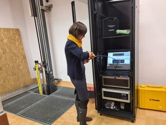
GNSS Receiver Calibration Laboratory
The main objective of the laboratory is to study and test multisystem GNSS satellite receivers for positioning quality and reliability.
This research includes an analysis of:
- measuring equipment, i.e. satellite receivers and antennas using a GNSS signal generator and calibration base
- Measurement errors of GNSS observations, including atmospheric delays, measurement noise, and hardware delays
- signal acquisition and precision positioning algorithms.
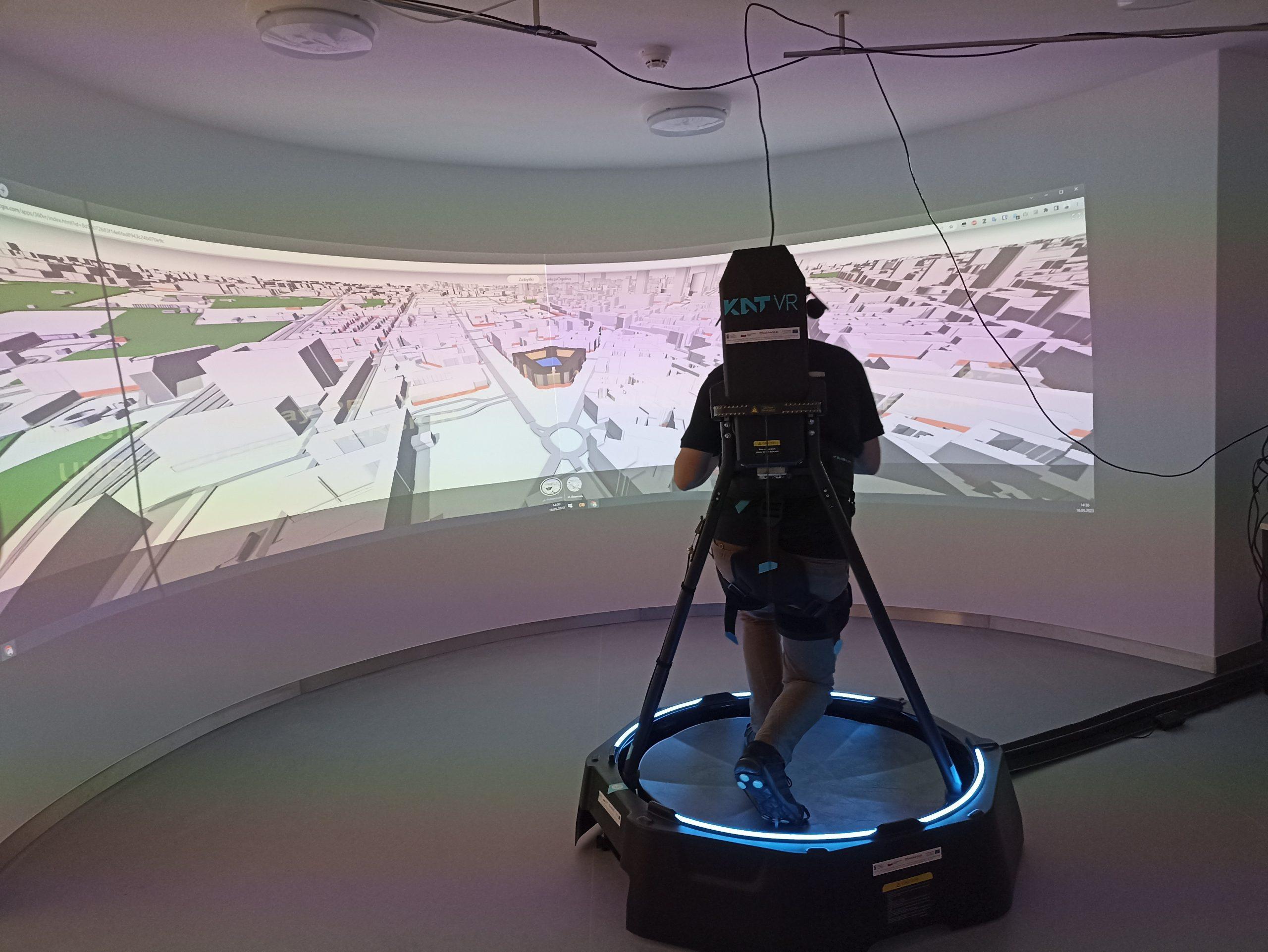
Indoor navigation/localization test fields
- Innovative concepts for cartographic visualization of building interiors
- Perception of navigation application under different conditions
- Testing the accuracy of position determination by navigation applications inside a building using various sensors
- Comparing positioning systems with different characteristics
The surveying, reference baseline for research, and calibration of measurement instruments
The main purpose of the laboratory’s operation is to perform calibrations of geodetic electromagnetic rangefinders to ensure measurement consistency across the country
This research includes:
- Determination of measurement uncertainty of tested rangefinders based on WUT200
- Determination of cyclic error (phase rangefinders)
- Determination of the addition constant
- Field test procedures for GNSS antennas
- Field test procedures for GNSS-RTK technology
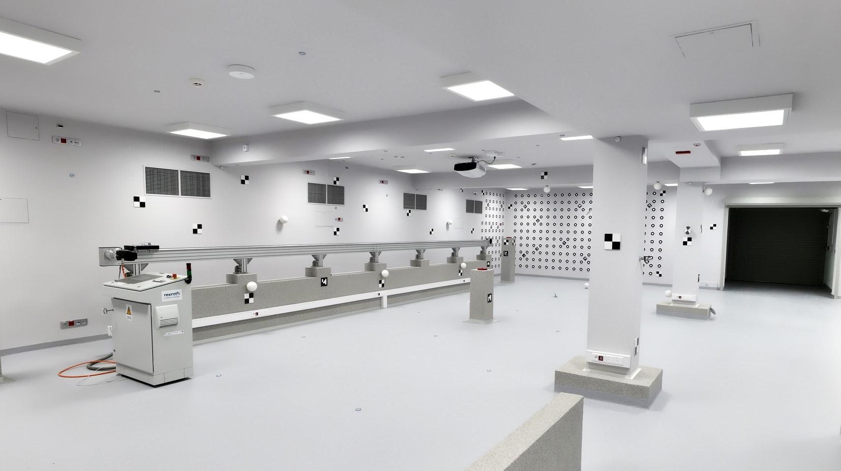
Terrestrial Laser Scanning and Photogrammetric Calibration Laboratory/Test Fields
The laboratory enables:
1) Testing/verification/calibration of active sensors:
- ground-based laser scanners
- RGB cameras
- electromagnetic rangefinders
- tachymeters
2) Testing/verification/calibration of passive sensors:
- cameras with different optical resolution and matrix
- optical shape mapping systems
- shape mapping algorithms and methods
- algorithms and methods of image processing
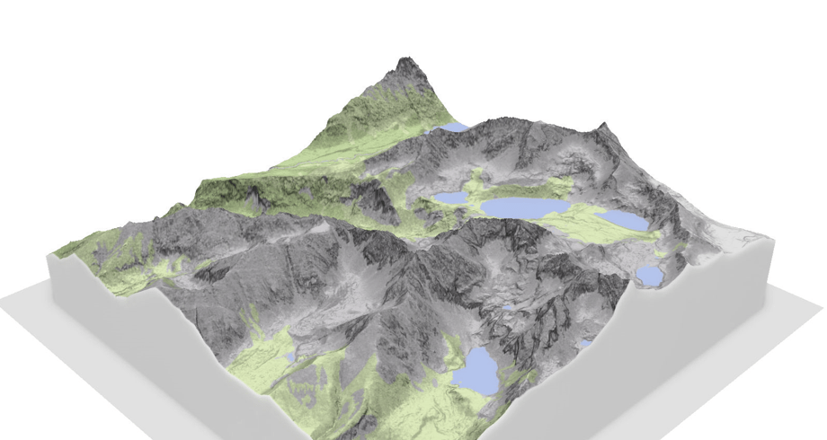
Aerial and Satellite Data Processing Laboratory
The main purpose of the research carried out at the laboratory is to perform complex large-scale processing of aerial and satellite data.
This research includes:
- Using BigData technology to work with remote sensing data collected on the CENAGIS Platform;
- Processing point clouds from aerial laser scanning using a GPU cluster;
- Integration and harmonization of remote sensing data (satellite, aerial, UAV);
- Spatial analyses, performed on a large scale ( voivodship, country) or on large volumes of data.
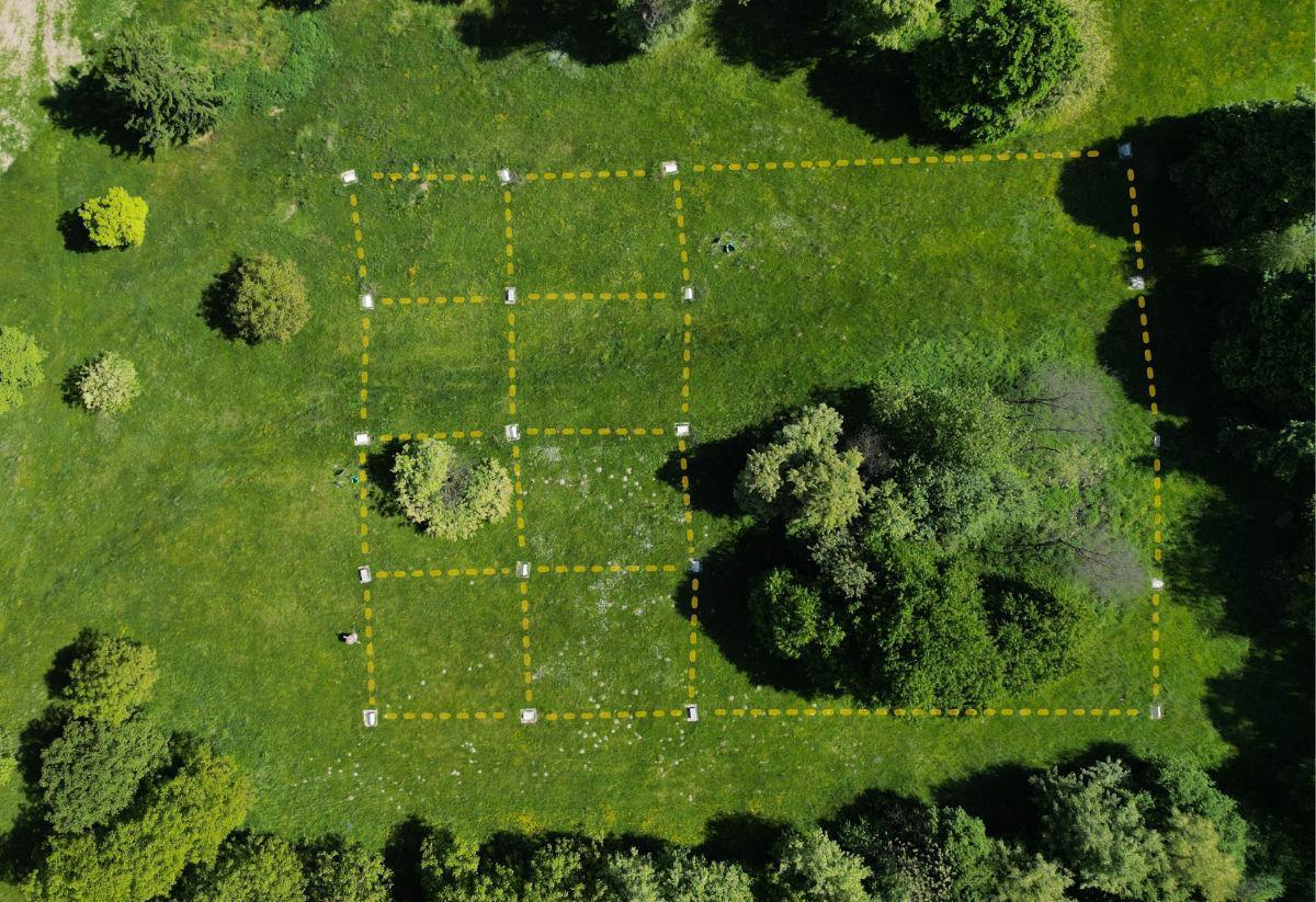
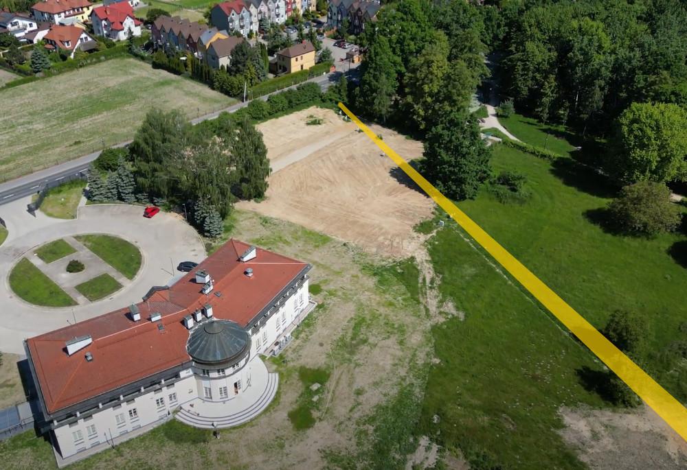
UAV test field
The main purpose of the test field’s operation is to calibrate and test remote sensing sensors mounted on unmanned aerial vehicles (UAVs).
The test fields allow:
- Perform calibration of photogrammetric cameras and laser scanners on UAVs;
- Evaluate the accuracy of UAV-mounted measurement systems;
- Evaluate the penetration of laser scanners on UAVs through vegetation.
You are welcome to rent our hardware
We have, among other things:
- Spirent’s top-of-the-range satellite signal simulator/generator (GSS 9000)
- Top-of-the-range multi-frequency and multi-constellation GNSS reference receiver with integrated OCXO-type oscillator (Septentrio PolaRx5S)
- Straight runner with carriage for object movement (BOSH-RETROX)
- Industrial Laser Tracer for highly accurate 3D measurements (API RADIAN Pro)
- Photogrammetric calibration field for calibration/testing/calibration of laser scanners
- External calibration measurement base (7 stabilised poles with atmospheric sensors, power supply, web access)
- High-end multimedia systems: projectors, devices for Virtual, Augmented and Mixed Reality systems (Oculus Rift, Primax 8K, HTC Vive Pro Eye, via Hololens to VuzixM400.) , including high-end computer graphics stations
- Indoor positioning system based on BLE beacons
- Absolute gravimeter (FG-5 No. 230 – one of dozens of such designs in the world, the only one of its kind and the most accurate in Poland)