Astronomical-Geodetic Observatory
of the Warsaw University of Technology
Objectives of operation
The observatory began operations in 1958 and has been participating in international research programs ever since. Permanent GNSS measurements have been carried out at the observatory since 1996.
The observatory’s tasks include:
- regular analysis of GNSS observations as the EPN Analysis Center (WUT EPN AC).
- participation in the EPN reprocessing project (re-analysis of all GNSS observations since 1996 in a consistent manner, using the latest models)
- analysis of GNSS observations of the ASG-EUPOS network
- Testing new computational strategies for GNSS observations and analyzing the results (station coordinates and velocities, tropospheric delays)
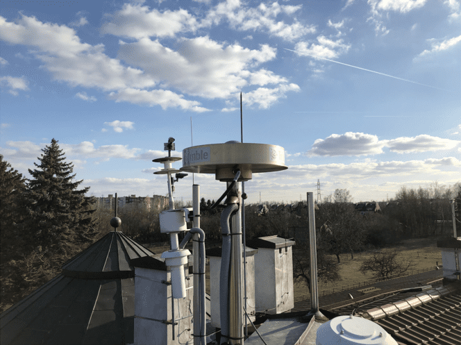
Continuous observations to GNSS satellites are made at the Observatory:
- GPS, GLONASS, Galileo, BeiDou, Qzss, Navic
Two credits (JOZE, JOZ2) included in international research programs:
- IGS – International GNSS Service,
- EPN ang. EUREF Permanent Network,
- EPOS – ang. European Plate Observing System.
JOZE, JOZ2 points are reference stations in global, regional and national earth reference systems (ITRF2014, IGb14, ETRF2014, PL-ETRF2000)
The CENAGIS infrastructure in Józefosław also makes it possible to expand the activities of the Astronomical and Geodetic Observatory with new elements, such as:
- System for automatic processing of GNSS observations in near real time (hourly calculations)
- Analysis of GNSS observations in the EPN reprocessing project (from 1996 to the present)
- Analysis of GNSS observations of the ASG-EUPOS network (since 2008).
- Service for determining crustal deformations caused by non-tidal loading effects