We invite you to cooperate with us!
The idea of cooperation
The infrastructure is available on a transparent basis to research units, businesses and public institutions. The benefits of cooperation should be seen in access to unique, innovative infrastructure and in joint creation and implementation of research and development programs in the future.
In carrying out research projects, partners and members of the Scientific Geospatial Analysis Network will:
– use services developed by other teams of scientists (as part of previous research),
– develop existing solutions (e.g., advanced data analysis algorithms),
– influence the shape of the built infrastructure.
The issue of creation (ownership) of the infrastructure and authorship (co-authorship) of research projects (or commercialization of research) are separable issues (PW does not automatically become a co-author of projects carried out by partners using the infrastructure).

You are welcome to rent our hardware
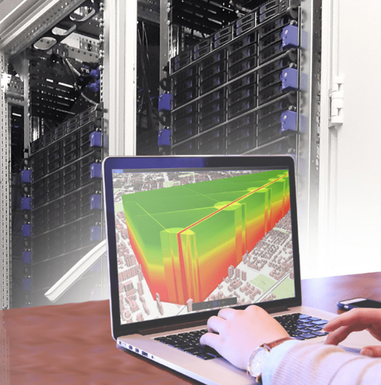
We have, among other things:
- MERCATOR computer cluster with NVIDIA GPU T4, V100, A100, and configuration for AI analysis
- ROMER computer cluster
- Spirent’s top-of-the-range satellite signal simulator/generator (GSS 9000)
- Top-of-the-range multi-frequency and multi-constellation GNSS reference receiver with integrated OCXO-type oscillator (Septentrio PolaRx5S)
- Straight runner with carriage for object movement (BOSH-RETROX)
- Industrial Laser Tracer for highly accurate 3D measurements (API RADIAN Pro)
- Photogrammetric calibration field for calibration/testing/calibration of laser scanners
- External calibration measurement base (7 stabilised poles with atmospheric sensors, power supply, web access)
- High-end multimedia systems: projectors, devices for Virtual, Augmented and Mixed Reality systems (Oculus Rift, Primax 8K, HTC Vive Pro Eye, via Hololens to VuzixM400.) , including high-end computer graphics stations
- Indoor positioning system based on BLE beacons
- Absolute gravimeter (FG-5 No. 230 – one of dozens of such designs in the world, the only one of its kind and the most accurate in Poland)
Offer for scientific institutions
We invite all interested scientific units to cooperate with us.
The suggested form of cooperation offering the greatest opportunities is to join the Scientific Network for Geospatial Analysis.
It is also possible to sign bilateral agreements.
Offer for business
We invite all companies interested in performing R&D work using CENAGIS to cooperate with us, in particular:
1. Use of computing power and access to a spatial data repository in R&D work
2. Testing its technological solutions on large geospatial data sets (big data infrastructure)
3. Periodic presentation of its technological solutions to customers
4. Verification of geospatial data created
5. Presenting its technological solutions to the broad community of scientists involved in geospatial data analysis (through the Scientific Network for Geospatial Analysis)
6. Seeking scientists (geo data scientist) for collaboration (through the Geospatial Analysis Science Network)
7. Jointly applying for research projects.
If you are interested in cooperation, please send your inquiry to: biuro.cenagis@pw.edu.pl
Price list for the service of access to IT resources of CENAGIS Platform
is valid from 1 March 2025.
| Type of component of the IT resource pool | Unit parameter | Net price |
| Virtual vCPU | 1 CPU / month | 18,00 PLN |
| Virtual vRAM operating memory | 1 GB / month | 10,00 PLN |
| GPU access | 2 GB / month | 80,00 PLN |
| Virtual vHD storage space | 100 GB / month | 8,00 PLN |
| Perform calculations on the big data subsystem (outside the test period) | 10% cluster power/day | 350,00 PLN |
| Technical submission | 1 piece. | 100,00 PLN |
| Access account – additional (first two free) | 1 piece. / month | 25 PLN |
| Downloading large volumes of data | 1TB | 45 PLN |
| Windows Server 2019 | 1 piece. / month | 60 PLN |
| Access to additional commercial software | Individual pricing | Individual pricing |
For orders with a net value exceeding 40,000 PLN that are paid in advance, a discount of 10% may be granted.
In the case of projects in which the Supplier and the Recipient are consortium members, settlements are carried out according to the possibilities arising from the regulations of competition.
Price list for the service of access to GNSS simulator - Spirent GSS9000
is valid from March 1, 2025.
| Type of component | Unit parameter | Minimum number of settlement units | Net price | VAT Tax |
| Production/research use of the Spirent GSS9000 generator | 1 hour | 5 | 170,00 zł | 23% |
| Assistance from a qualified PW employee to facilitate the operation of the device | 1 hour | 2 | 115,00 zł | 23% |
| Assist the lab supervisor to provide access to the device during the testing period | 1 hour | 1 | 35,00 zł | 23% |
| Additional expert services and training related to the use of the simulator | 1 hour | 1 | 150,00 zł | 23% |
Free trial use of the Spirent GSS9000 simulator is possible in order to learn the to learn the operation for a maximum of 24 hours. In this case, the paid assistance of the laboratory supervisor is required.
For orders with a gross value of more than PLN 15,000, a discount of 10%.
In case of projects in which the Supplier and the Recipient are consortium members, prices are shaped are shaped individually depending on the specifics of the Project and the source of funding, while striving to maintaining the price list values given above.
Price list for the service of access to Laser Tracker API Radian
is valid from March 1, 2025.
| Type of component | Unit parameter | Minimum number of settlement units | Net price | VAT Tax |
| Production/research use of the Laser Tracker API Radian | 1 hour | 2 | 150,00 zł | 23% |
| Assistance from a qualified WUT employee to facilitate the operation of the device and ensuring equipment safety | 1 hour | 2 | 115,00 zł | 23% |
| Assist the lab supervisor to provide access to the device | 1 hour | 0 | 35,00 zł | 23% |
| Additional expert services and training related to the use of the Laser Tracker | 1 hour | 0 | 150,00 zł | 23% |
Free trial use of the Laser Tracker API Radian is possible for learning purposes, with a maximum duration of 3 hours. In this case, paid assistance from a laboratory supervisor is required.
For orders with a net value exceeding 15,000 PLN and paid in advance, a discount of 10% may be granted.
In the case of projects where the Supplier and Recipient are consortium members, prices are individually determined depending on the specifics of the Project and the source of funding, while aiming to maintain the list prices given above.
Price list for the service of access to spectrophotometer i1Publish Pro 3
is valid from March 1, 2025.
| Type of component | Unit parameter | Minimum number of settlement units | Net price | VAT Tax |
| Production/research use of the spectrophotometer | 1 hour | 2 | 120,00 zł | 23% |
| Assistance from a qualified WUT employee to facilitate the operation of the device and ensuring equipment safety | 1 hour | 2 | 115,00 zł | 23% |
| Assist the lab supervisor to provide access to the device | 1 hour | 0 | 35,00 zł | 23% |
| Additional expert services and training related to the use of the spectrophotometer | 1 hour | 0 | 150,00 zł | 23% |
For orders with a net value exceeding 10,000 PLN and paid in advance, a discount of 10% may be granted.
In the case of projects where the Supplier and Recipient are consortium members, prices are individually determined depending on the specifics of the Project and the source of funding, while aiming to maintain the list prices given above.
Cooperation with research teams
TEAM OF THE CENTER OF GEOSPATIAL ANALYSIS - CENAGIS
The team, consisting of staff from various departments, has been conducting interdisciplinary research in geoinformation in cooperation with other research teams of the Warsaw University of Technology and other universities and research institutes. Since 2020, it has been using for this purpose the cyberinfrastructure of geospatial information CENAGIS. The team’s activities are focused on automation and efficient processing, analysis, and visualization of geospatial big data, including satellite images, aerial photos, point clouds from laser scanning, and various spatially referenced vector data.
Previous clients of the team include:
Head Office of Geodesy and Cartography, Digitization Department of the Capital City of Warsaw, Municipality of Żuromin, OPEGIEKA, Comtegra, Cloudferro, Tensorflight and Cenatorium.
- analysis of large sets of geospatial data and development of algorithms for spatial analyses
- verification of scientific hypotheses related to phenomena in geographic space
- detection of phenomena and objects in space
- detection of relations and interdependencies of phenomena and objects in space
- creation of models of phenomena, processes, and objects related to geolocation
- testing data used in navigation applications
- integration and analysis of 3D airborne, satellite, and ground data
- processing and integration of multi-sensor satellite data and multi-source geospatial data
- development of innovative concepts of cartographic visualization
- expert opinions on spatial data quality and compatibility of data models with standards
dr hab. inż. Dariusz Gotlib, prof. uczelni
dariusz.gotlib@pw.edu.pl
DIANA/NATO Test Center
The Defence Innovation Accelerator for the North Atlantic (DIANA)
seeks to unite the best and brightest innovators across the Alliance.
DIANA provides deep tech and dual-use innovators with access to NATO resources, including grant funding, acceleration services, and pathways to adapt their solutions for defence and security needs
WUT’s Center for Scientific Geospatial Analysis (CENAGIS) has been approved as one of the DIANA Test Centers and is the only one with such a profile in the world.
The agreement with the Warsaw University of Technology was signed in August 2023. In March 2024, the network of test centres around the world expanded twofold.
Detailed information on DIANA’s program of activities and announced grants can be found here:
https://www.diana.nato.int/
https://www.diana.nato.int/test-centres.html
https://pfrsa.pl/technologiedlaobronnosci.html
https://startup.pfr.pl/pl/aktualnosci/mon-i-pfr-zainaugurowaly-akcelerator-diana-nato-w-polsce/
We’d like to invite you to use the CENAGIS infrastructure to test your solutions and conduct research by both research entities and commercial companies.
In particular, we offer:
- Access to computing power and to a repository of spatial data (including work on graphics cards and using AI)
- The ability to test your applications and algorithms on large geospatial datasets (spatial big data)
- Use of advanced geospatial analysis software and support in performing analyses
- Access to a Navigation and Location Application Testing Laboratory equipped with VR/AR devices and an indoor navigation testbed
- Access to the GNSS Receiver Testing Laboratory (including a top-of-the-line Spirent GNSS signal generator)
- Calibration laboratory for laser scanners and digital cameras
- UAV test field
For more information, see the subpages:
https://cenagis.edu.pl/en/platform/
https://cenagis.edu.pl/en/labs/
We are proud to be part of this important endeavor. We would like to invite you to contact us and cooperate.
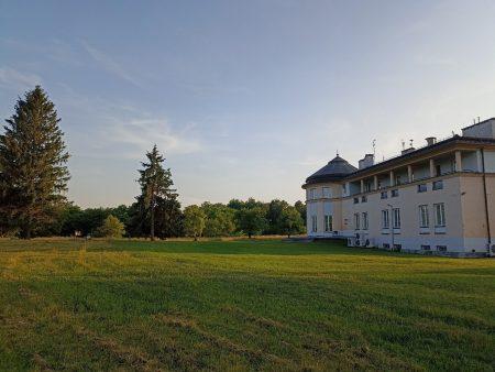
You are welcome to use our residence and conference facilities
We have, among other things:
- Conference room (30-50 persons) with multimedia equipment, including for internet broadcasting
- Small meeting rooms (6-10 people)
- Guest rooms
- Green recreation area
Price list of guest rooms and conference rooms
in the Science and Didactic Centre Józefosław (ONDJ)
Long-term accommodation (min. 1 month)
| Double room with bathroom | PLN 1,600 per month | |
| Double room with bathroom with higher standard | PLN 1,700 per month | |
| Single room without bathroom (shared bathroom in corridor) | PLN 900 per month | |
| Apartment | PLN 2400 per month |
Short-term accommodation (up to one month)
| Double room with bathroom | PLN 150 per day | |
| Double room with bathroom with higher standard | PLN 160 per day | |
| Single room without bathroom (shared bathroom in corridor) | PLN 80 per day | |
| Apartment | PLN 220 per day |
Conference rooms
| “Główna” (70 m2) | PLN 230 up to 2 hours, PLN 700 up to 8 hours, PLN 900 per day | |
| “Słoneczna” (40 m2) | PLN 120 up to 2 hours, PLN 350 up to 8 hours, PLN 450 per day | |
| “Kameralna” (40 m2) | PLN 120 up to 2 hours, PLN 350 up to 8 hours, PLN 450 per day |
Additional services
| Additional bed | PLN 40 | |
| Additional replacement of bed linen and towels | PLN 30 |
In the case of short-term accommodation, the cost of washing out bed linen and towels is not included.
In the case of long-term accommodation, the price includes the cost of linen and towels are changed once a month.
In case of using own bedding the price is reduced by 30 PLN (applies to the price for the first day or the monthly price).
WUT employees and students (where rooms are available) are entitled to a 25% discount on the prices set out in above tables.
For overnight stays directly related to the work and service of meetings, seminars, training courses, etc., the Dean of the Faculty of Geodesy and Cartography decides on the amount of the fee or the fee exemption.
The prices quoted are gross prices.